Documenting Impacts
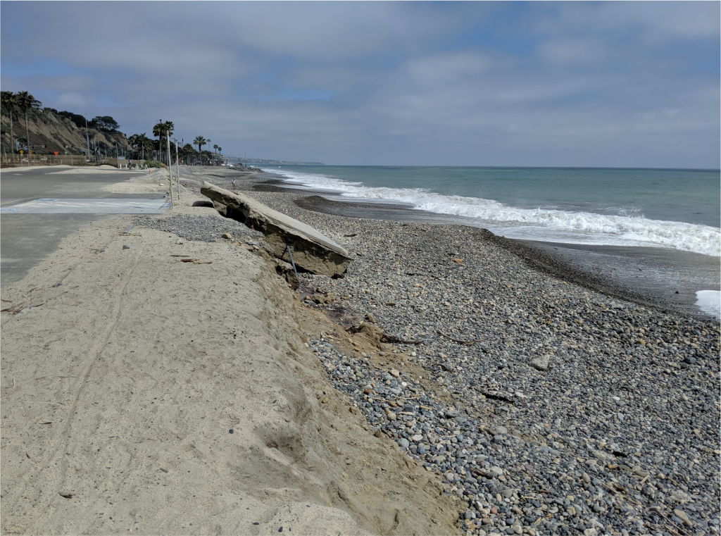
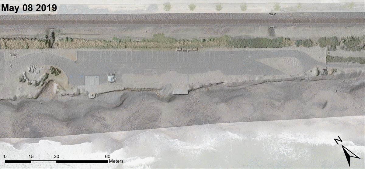
When sand is depleted from beaches, powerful wave energy comes closer to shore causing shoreline retreat and damage to human systems (e.g., recreational and transportation infrastructure). Monitoring programs are needed to document impacts to infrastructure, collect detailed data on site conditions, support the development and implementation of action plans, and monitor how well these action plans perform including impacts to human and natural systems. Figure 1 below shows shoreline erosion in 2019 and exposed human systems at South Doheny Beach.
Unmanned Aerial Vehicles (Drones)
Unmanned aerial vehicles (or drones) mounted with cameras and other sensors are an excellent platform for monitoring coastal topography and vegetation. Drones are programmed with a flight plan to collect a set of geo-referenced images over a region of interest, and imagery is post-processed using a technique known as Structure from Motion (SfM) to yield fine resolution digital topography models.
Digital elevation models are produced with a fine spatial resolution that reveals many important details with an accuracy of several centimeters or less including the position of the shoreline, the distribution of beach sand, the shape of beach cusps, and distribution of vehicles in the parking lot. Figure 4 below shows an overlay of a shaded digital elevation model with color imagery which documents features captured by the drone data.
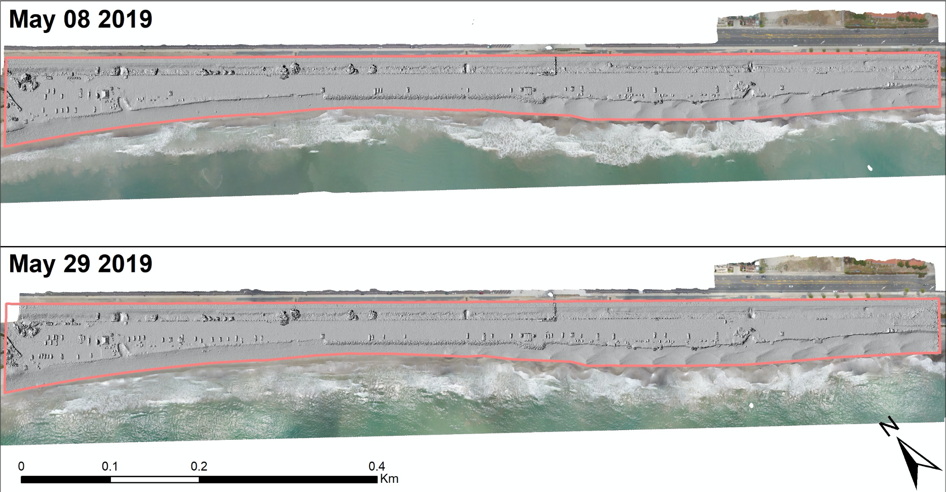
Repeated drone flights over the same site allows for direct measurement of topographic changes and intuitive visaulizations. Figure 5 below shows an animated reconstruction of site conditions before and after large wave event in May of 2019. The image reconstruction combines a hillshade plot based on the digital elevation model with color imagery acquired by the drone camera.
Summer Swell Event
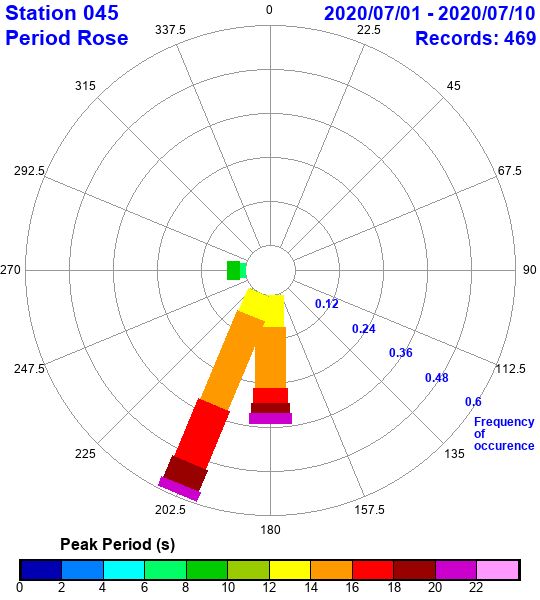
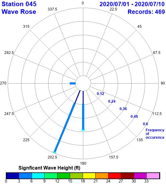
Monthly drone flights over Doheny Beach commenced in April 2020 and captured an erosion event in July, 2020 that resulted from long-period swell formed by low-pressure systems in the central South-Pacific Ocean. Waves were measured offshore with a period of 20-22 seconds, significant wave height of 6-9 ft arrived from almost due South (202.5 degrees) as shown in Figure 6.
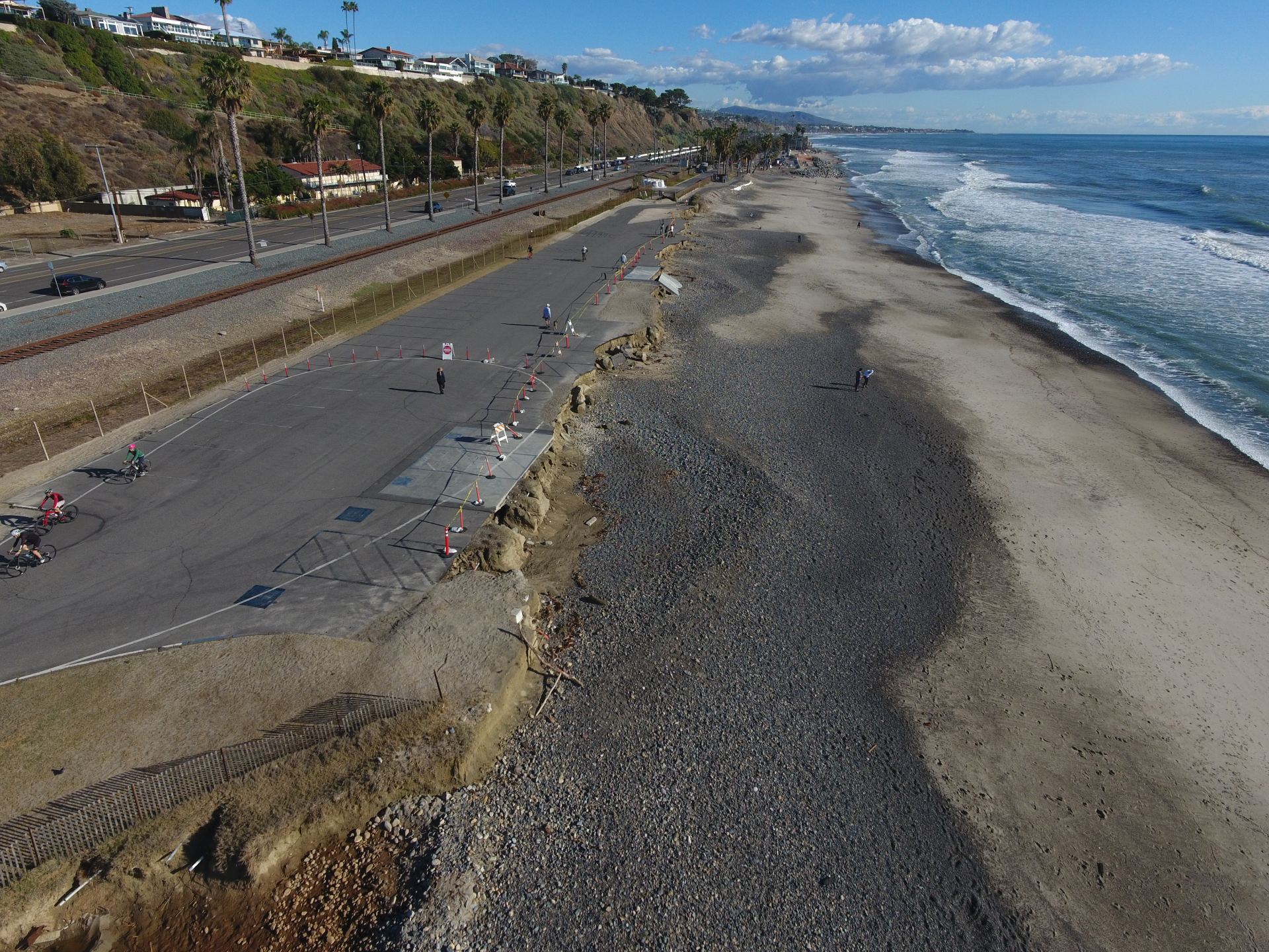
Imagery collected on July 10, 2020 showed damage to the day use area and further retreat of the escarpment that marks the upper limit of the beach face as shown in Figure 7.
Imagery acquisition from aerial drone flights followed by SfM Processing resulted in monthly digital elevation models showing topographic heights above the North American Vertical Datum (NAVD88) on a monthly basis. Figure 8 shows a visualization of the site topography for (A) April 30, (B) May 29, (C) June 30 and (D) July 10, 2020. In these images, three layers of information are overlayed: the base layer is a hillshade plot of the fine resolution digital elevation model processed from aerial imagery, the second layer is color imagery from aerial imagery, and the top layer are color contours based on topographic heights.
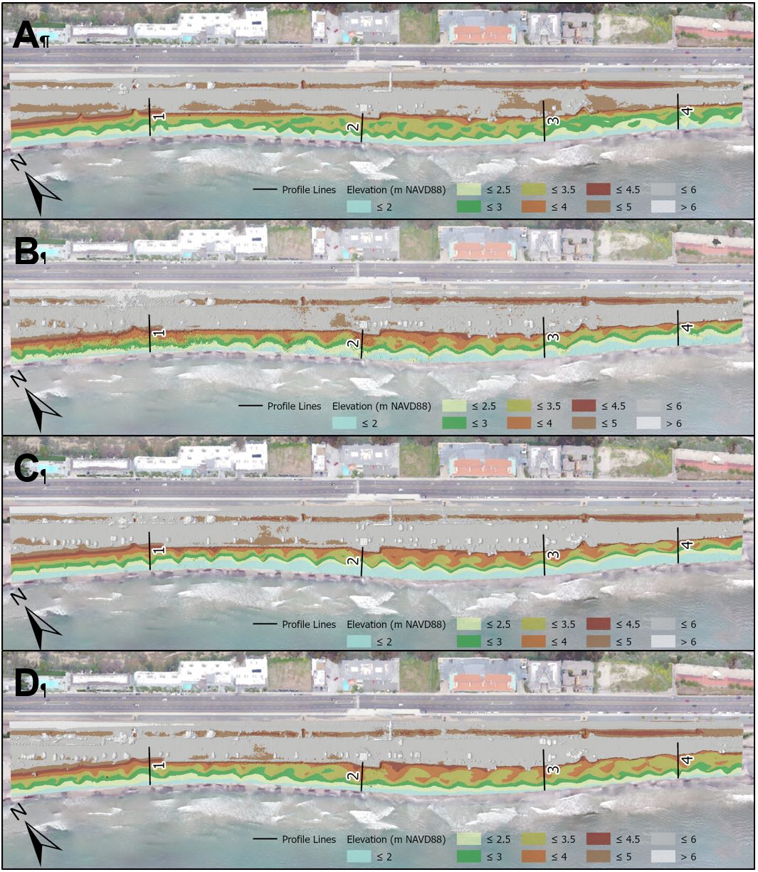
Figure 8 also captures the bedforms along the beach, a series bowl-like shapes known as beach cusps, which are created by the runup and rundown of waves and are constantly in motion. The beach cusps slowly move along the coast with each passing wave that displaces sediment.
Showing elevation alone, it is difficult to identify specific impacts, but by taking the difference between two digital elevation models, the changes in topography that occur between two dates is revealed.
Change in Height (m) = Height Measured at Time 2 (m) – Height Measured at Time 1 (m)
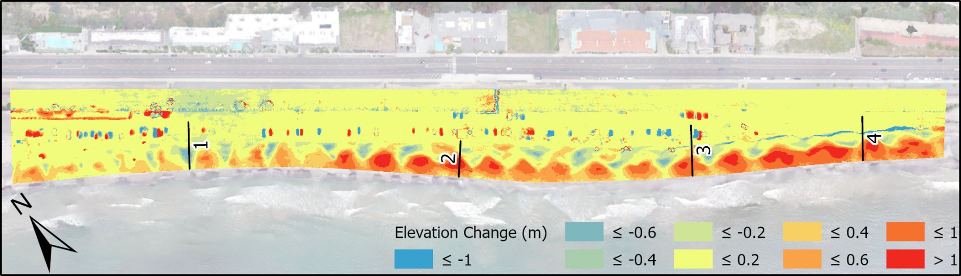
Figure 9 shows the difference in elevation that occurred between the period June 30 – July 10, 2021 and as a result of the large swell shown in Figure 6. Blue coloring denotes areas that experienced elevation loss (erosion) and red coloring denotes areas with elevation gain (deposition of sediment). This coloring shows that the large swell event, during which waves rushed high up the beach and onto the parking lot, eroded sediment from the top of the beach (causing a retreat of the escarpment) and deposited sediment on the lower part of the beach. The magnitude of these changes is significant: in places, ground elevation was lowered/increased by more than a meter.
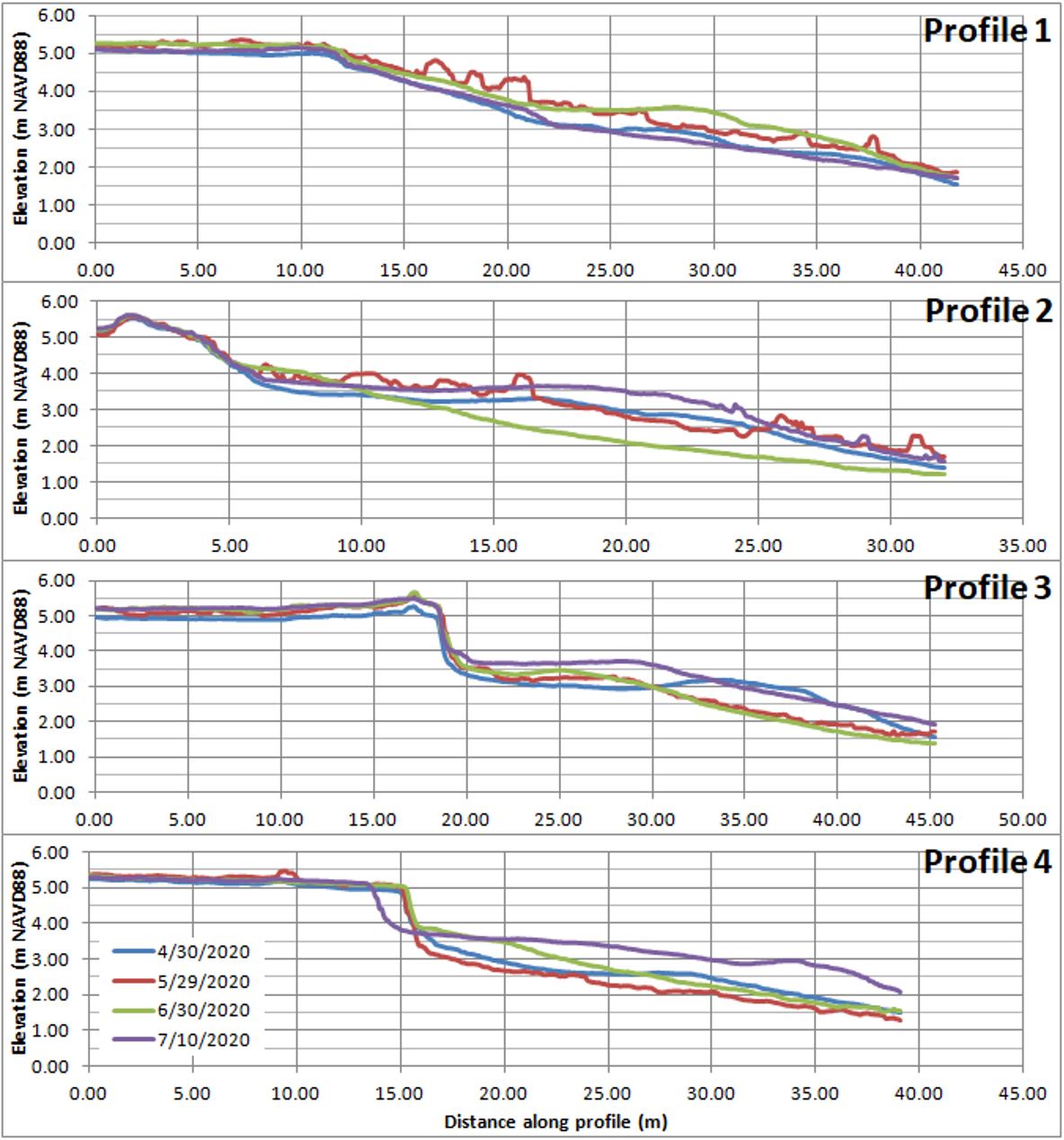
Figure 10 provides another perspective on elevation changes that is achieved by plotting profiles of topographic heights resolved by the digital elevation models along the four transects labeled 1-4 in Figures 8 and 9. In Fig. 10, note retreat of the edge of the beach parking lot at transect 4 (x-coordinate = 15 m) of over 1 m between June 30 and July 10, 2020. Also note that the elevations along the foreshore of the beach vary by roughly a meter on a monthly basis due to progression of the beach cusps and other beach-face morphodynamics.