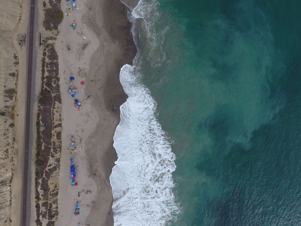
If you found yourself on a southern California beach enjoying the beautiful day, looking at the some of the biggest summer swells and lovely sunsets, you’ll be surprised to know that the sky is staring right back at you. Well, not exactly, but there are cameras watching earth as well as radar signals travelling all around you from satellites orbiting Earth. Out of some 4,000 satellites in space, only a few carry instruments powerful enough to make precise measurements of the world’s surface and atmosphere. Starting this summer, some of those satellites are targeted to study the California coastline.
Alongside the University of Houston, the University of California, Irvine Flood Lab and Metropolitan Beaches Project have recently been awared a NASA grant to improve spaceborne methods to measure coastal erosion and flood risks. The grant supports research to develop the next generation of coastal monitoring tools using satellite instruments.
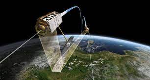
The grant will support the observation of several southern California beaches using a variety of satellites. These satellites are equipped with powerful cameras or radars, and will be used to monitor beaches, dunes, and cliffs. Detailed information on these features are essential to investigate coastal erosion, flood risks, and how these processes may be affected under a changing climate. Here, we will apply available satellites, such as TanDEM-X (German Space Agency), IceSAT-2, LandSATs 5, 7, and 8 (NASA), and Sentinel-2 (European Space Agency). While each satellite provides useful data, such as shoreline position from imagery and radar, and elevation using altimetry, this project will focus on data acquisitions from the TanDEM-X radar satellite (read more about radar SAR and InSAR). The TanDEM-X satellite consists of two satellites flying in close orbit, which allow for more accurate measurements of earth features (see publications by Dr. Milillo regarding InSAR processing methods).
When it comes to coastal monitoring, satellites are perfect for routine measurements of beaches and dunes at unprecedented levels. Our project goal consists of investigating how well space based observations are able to detect changes in beach surface and vegetated dunes over time, improving our understanding of coastal morphology relative to swells and climate dynamics, and to better identify possible flooding hot spots. InSAR mapping of coastal features is the cutting-edge of applied technology, so the accuracy must be quantified to understand its possible uses and limitations- and continue to improve these amazing tools.
Field Data Collection Campaign
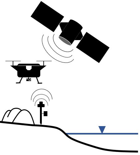
The first part of the project involves validating radar observations from TanDEM-X, so a baseline dataset must be established using traditional methods of measuring beaches and dunes. Traditional methods of measuring these coastal features include GPS point data, and aerial photogrammetry and LiDAR.
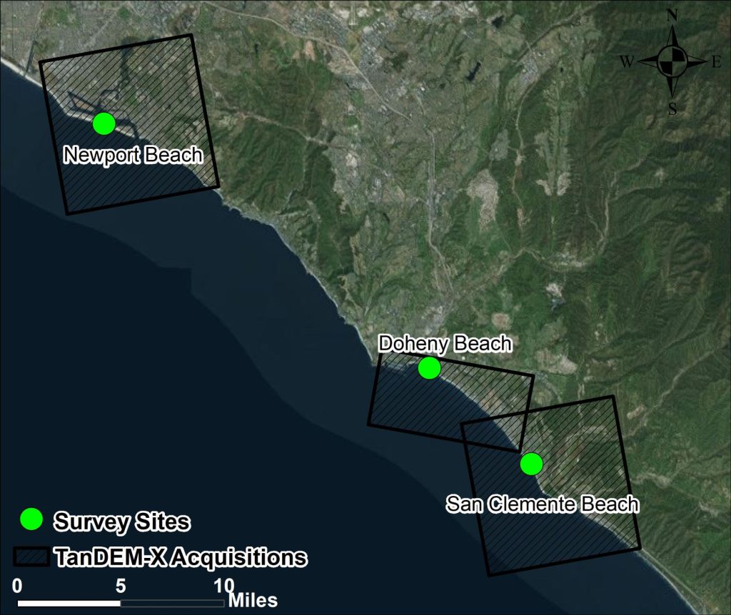
During the summer and fall of 2022, we’ll be conducting ground and drone-based survey missions at three beaches in Southern California: Newport Beach, Doheny State Beach, and San Clemente State Beach (and a beach near the US-MX border). We know the exact time to the second that the TanDEM-X satellite transmits signals to earth, so we use that information to plan the survey schedule. This sometimes means that data must be collected as early as 5 am!
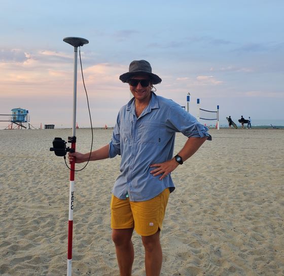
The most accurate level of data is obtained via ground-based measurements of position and elevation using a GPS. Think of it as the gold standard. GPS receivers use signals from navigational satellites (GNSS- Global Navigation Satellite Systems) to triangulate position and elevations on earth. Our measurements can be improved by tapping into correctional signals made available from the California Real Time Network, a statewide network that utilizes existing base stations to support more accurate positioning. We are talking about using signals from space to get centimeter-level position accuracy. A GPS survey consists of a nice, long walk on the beach with a tall antenna in arm.
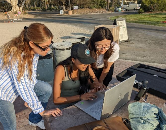
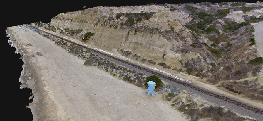
GPS data is very accurate, but it takes hours of walking even to cover a small area of beach with sparse data. While long walks on the beach do sound fun, we can also capture data over larger areas, must faster, with drones. Drones can be mounted with cameras or lasers which scan the beach surface (LiDAR). From both photos and laser data, we can generate a cloud of millions of 3D points, each representing a spot on the surface of the coast. By joining all the points in the cloud together, a 3D reconstruction of the beach can be generated, called a digital elevation model (DEM). While drone-based measurements collect much more data than a GPS survey, their precision isn’t as accurate as the GPS method. That’s why we apply several different techniques to tell us how comparable the satellite derived data is.
The survey campaign will be completed in October, 2022. Once the accuracy and resolution achieved with the satellite data is established, the next phase will be to apply these novel datasets to assess coastal flood hazards, and monitor southern California beaches and dunes.
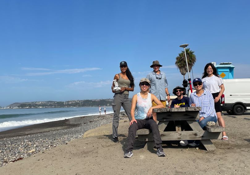
In the meantime, if you see one of us from the UCI Flood Lab out on the beach, flying drones or walking with our GPS receiver, don’t be shy, come say hello and hear about our research updates!
For more information, reach out to Daniel Kahl at dkahl1@uci.edu